Sunday, October 28, 2012

Golden Gate Bridge

For today’s post, I was requested to visit the Golden Gate Bridge.


The Golden Gate Bridge is a suspension bridge in San Francisco, California. The bridge extends across the Golden Gate, the opening of the San Francisco Bay into the Pacific Ocean. The bridge was constructed between January 5, 1933 and April 19, 1937. It opened to traffic on May 27, 1937. The bridge is used by about 120,000 vehicles a day.

From the Wikimedia Commons. Retouched.
The official color of the bridge is “international orange”. The color was selected because of its visibility in fog and how it complemented its natural surroundings. The bridge is 8,981 feet long and 746 feet high. It was designed by Joseph Strauss, Irving Morrow and Charles Ellis.

From the Wikimedia Commons. Retouched.
Bing Maps provided satellite and “Bird’s Eye” perspectives on the bridge. Google Maps provided “Street View” photographs.


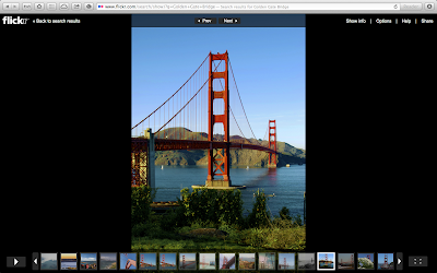
Fotopedia had some jaw-dropping, gorgeous photographs of the Golden Gate Bridge.


Flickr’s collection, while extensive, paled in comparison to Fotopedia’s.


While the Golden Gate Bridge did have an official website, the website was sparse and information on the bridge was scattered across several pages. Wikipedia was the best source of information I found.


The Golden Gate Bridge is a beautiful architectural feat. It stands as an iconic symbol of both San Francisco and the United States.

Sunday, October 21, 2012

Pripyat

Today, I decided to visit an unusual place. So, I picked Pripyat.


Pripyat is an abandoned city in the Chernobyl Exclusion Zone in northern Ukraine. It was founded in 1970 to house workers at the Chernobyl Nuclear Power Plant and their families. It was officially proclaimed a city in 1979. Unfortunately in 1986, when Pripyat was the Soviet Union’s ninth nuclear city with a population of about 50,000, it was abandoned in two days due to the Chernobyl disaster.


From the Wikimedia Commons
Before the disaster, Pripyat housed about 50,000 people in 13,414 apartments and 26 residence halls. It had 15 primary schools, 5 secondary schools and 1 professional school. It also had 25 stores and malls; 27 cafeterias and restaurants; 10 gymnasiums; a cultural palace; a cinema hall and a school of arts. Because of the haste in which the city was abandoned, visitors to the ghost town can still find objects like kitchen utensils, toys and clothes left exactly where their owners had been using them or put them down.


From the Wikimedia Commons
Google Maps pulled up satellite images of Pripyat, showing it plainly in its sad, abandoned state.


It even had a few “Street View” photographs shared by people on the Internet.


Fotopedia had photographs of Pripyat among the ones on its page for the Chernobyl Exclusion Zone. Flickr pulled up a slideshow of photographs of Pripyat shared on its network.


Wikipedia was a good source of information on Pripyat.


Earlier this year, a horror movie titled Chernobyl Diaries hit theaters. The movie was partly filmed at Pripyat. While I personally feel it didn’t live up to its potential, it was fascinating to see the locations they filmed at in Pripyat. Here is the trailer (trailer rated for “Appropriate Audiences”):


What I find fascinating about Pripyat is that it is an entire, modern city that is completely abandoned. Buildings, playgrounds and facilities fall to ruin, perhaps showing us a glimpse into what a post-apocalyptic world would look like.

Sunday, October 14, 2012

Sydney Opera House

This week I decided to visit the Sydney Opera House.


The Sydney Opera House is a performance arts center in Sydney, Australia. It opened in 1973 and was largely built by Danish architect Jørn Utzon. Interestingly, Jørn’s design for the Sydney Opera House won the competition to come up with a design for it in 1957. It was made a UNESCO world heritage site on June 28, 2007.

From the Wikimedia Commons. Retouched.
Contrary to what its name would suggest, the Sydney Opera House houses multiple performance venues. It is among the busiest performance art centers in the world, hosting over 1,500 performances a year attended by around 1.2 million people. It is also one of the most popular tourist destinations in Australia, being visited by about 7 million tourists a year.

Interior of the Concert Hall at the Sydney Opera House.
From the Wikimedia Commons. Retouched.
Google Maps had nice satellite and “Street View” perspectives of the Sydney Opera House. Bing Maps had a nice “Bird’s Eye” perspective of it.


Fotopedia served up pictures of the Sydney Opera House in a special online magazine format, coupling beautiful photographs with great information.


Flickr served up 200,866 professional and amateur photographs of the Sydney Opera House.


The best sources of information I found were Wikipedia and the Australian government’s website. The official website for the Sydney Opera House provided information for planning your trip and on past and present performances.


The Sydney Opera House is a beautiful and uniquely constructed building. It rightfully is a place you must visit at least once in your life.

Sunday, October 7, 2012

The Hoover Dam

As with all my weekly escapades, I begin this one with a web search.


The Hoover Dam is a dam built in the Black Canyon of the Colorado River on the border of Arizona and Nevada. The dam was constructed between 1931 and 1936, having been dedicated on September 30, 1935 by President Franklin Delano Roosevelt. It helps control floods, provide irrigation water and generate hydroelectric power.

From the Wikimedia Commons
The Hoover Dam was constructed during the Great Depression. While it was originally referred to as the “Boulder Dam” or “Boulder Canyon Dam” (despite the fact that the construction site was moved to Black Canyon), U.S. Secretary of the Interior Ray Lyman Wilbur under President Herbert Hoover called it the “Hoover Dam” while speaking at a ceremony on September 17, 1930. Controversy followed, with President Franklin Delano Roosevelt and his Secretary of the Interior Harold LeClair Ickes trying to revert the name to “Boulder Dam”. The controversy was finally settled in 1947 when a bill passed unanimously by both Houses of Congress restored the name to “Hoover Dam”.

Photo Credit: L. Richard Martin, Jr. Retouched.
Bing Maps pulled up satellite and “Bird’s Eye” views of the Hoover Dam. Google Maps provided a “Street View” based on photographs shared by people on the Internet.


Flickr and Fotopedia served up slideshows with beautiful professional and semi-professional photographs of the Hoover Dam (Fotopedia’s collection seemed much more refined).


The best source I found for information on the Hoover Dam was Wikipedia, though the U.S. Department of the Interior also has a website with historical and visit-related information for the dam.


The Hoover Dam is a marvel of American ingenuity, standing tall and strong as another example of what the greatest minds and hardest workers can accomplish even in times of desperation.